Truk (Chuuk)
Location: Central Caroline Islands, Western Pacific, Federated States of Micronesia
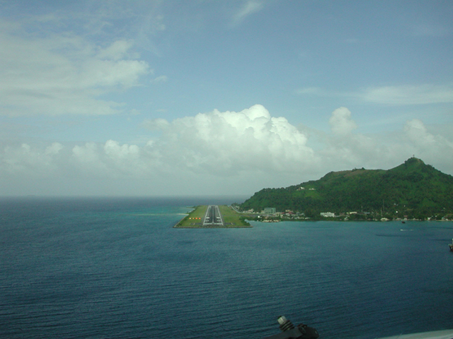
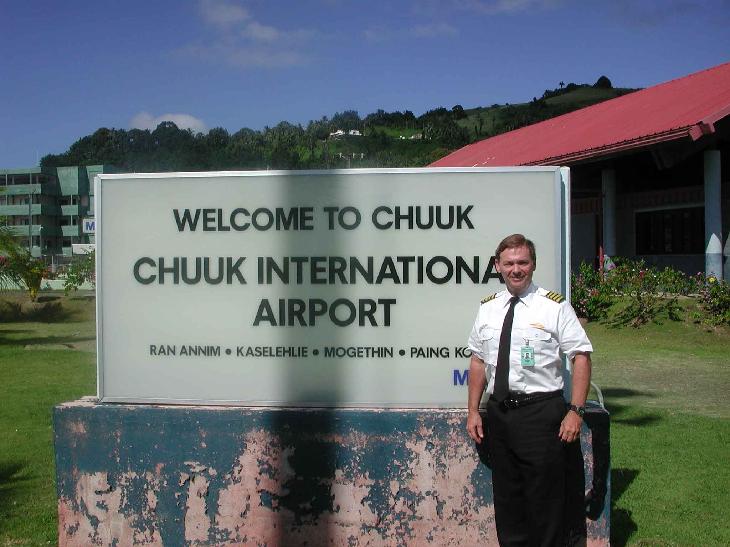
Description: Chuuk Lagoon is the largest single barrier reef in Micronesia, enclosing reefs and a lagoon with 26 volcanic islands and 22 low coral islets. It is also the largest urban center and the capital of Chuuk State in Micronesia, home to nearly 50,000 residents living mostly on several of the larger volcanic islands. The atoll is noted for an exceptional diversity of fish, marine invertebrates, and coral species (about 300 species of stony corals were recently cataloged here). Chuuk is also a significant cultural center having been continually occupied by Micronesians over the past several thousand years. During World War II, nearly 70 Japanese naval vessels were sunk during a 1944 battle, Operation Hailstone. During the past half century the wrecks have been colonized by fish, sponges, seaweeds, and soft corals. The shipwrecks of the lagoon are now one of the premier sport diving destinations in the world due to luxuriant reef growth and the historic significance of the wrecks. Several dive operations and most of the subsistence fishermen rely on the reefs and lagoon for their catch.
Threats: Japanese military construction and Operation Hailstone were the first major insults to Chuuk's coral reefs. After the war the human population expanded rapidly, placing ever increasing demands on marine food resources (reef fish and shellfish). Fishers have removed explosives from the residual World War II munitions on the atoll, making them into bombs and using them to blast reefs to stun, kill, and collect fish. Blast fishing is still a serious threat to reefs, especially in the more remote western lagoon, beyond the watchful eyes of villagers and government enforcement. Blasting has damaged about 10 percent of the reefs in the lagoon according to a 1994 survey. Heavy urbanization, especially on Tonowas and Weno, has spurred dredging and filling for land expansion and development, while sewage discharges into the lagoon from the islands has reduced water quality and subsequently underwater visibility at many of the dive sites. Reef fish populations are being depleted from heavy fishing pressure, and nesting sea turtle populations have nearly been eliminated from the area. Rubbish is haphazardly dumped into mangrove areas on the most populated islands, further degrading water quality.
POHNPEI
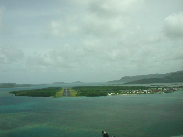
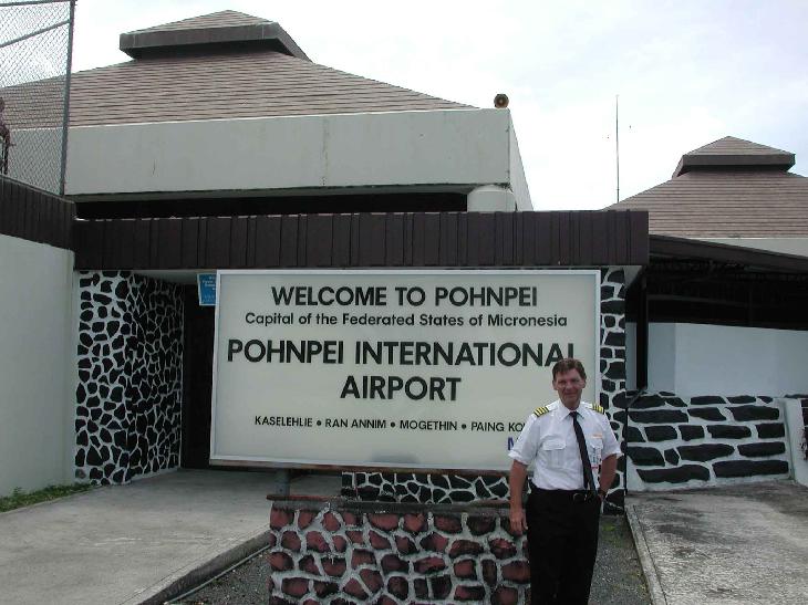
Located about halfway between Honolulu and Manila, Pohnpei lies in the middle of the Eastern Caroline Islands. It is the largest island in the Federated States of Micronesia with a land area of 334 square kilometers, boasts a towering, rugged interior and is of volcanic origin. Pohnpei island is a deeply indented, jagged circle, some 21 kilometers in diameter, 112 kilometers in circumference. Its main features of topography are the outer barrier reef, the intertidal lagoon, the fringe reef and mangrove forest, the lowland area on the outer edges of the island, and the central mountain rain forests.
Pohnpei state is divided into 11 political municipalities. The main island is ringed by 25 smaller widely scattered coral atolls which lie outside the barrier reef. Pohnpei's population of around 34,000 lives mostly on the main island and are engaged in subsistence agriculture and a variety of cottage agricultural and handicraft industries. Pohnpei's pepper for example, though expensive, is regarded as the finest in the world. Pohnpei island's shoreline is mostly covered by mangrove swamps and some artificial beaches have been created to allow easier water access. The nearby atoll islands however, boast magnificent beaches.
Pohnpei has recently been tagged the "Garden Island" of Micronesia and, with one look at the luxuriant inland vegetation, it's not difficult to understand why. The island abounds in tropical forests, cascading mountain streams, spectacular waterfalls, hidden pools and exquisite flora. Most intriguing of all of Pohnpei's spectacles are the ruins of Nan Madol, an ancient Venice-like city from which, it is said, the Saudeleurs ruled Pohnpei. Apparently, the construction and modification of Nan Madol (which is made up of some 92 man made islets) commenced at around 500 AD and some of the buildings have been dated to as recently as 1500 AD. The major buildings were constructed of immense stone logs, six meters long weighing several tons. Some of these logs are stacked crisscross, to form walls 12 meters high and five meters thick! The Saudeleurs are believed to have taken over at around 1000 AD and remained in power until they were defeated in 1628. Nan Madol, because of its remote sea-shore location is best accessed by boat. Also, because of the huge size (80 hectares), it is impossible to see more than a handful of islets on any one trip.
The more adventurous will revel in Pohnpei's underwater spectacles, especially at Ant and Pakin Atolls. Pakin boasts some of the best gorgonian fans in the world. The outlying islands are accessible by boat, and In the reef surrounding the main island, 18 passes offer a wide variety of coral and marine life viewing, including sharks and mantas. In Kolonia more recent history abounds in the Spanish Wall (built in 1899), the German Mission Bell Tower, and the two cemeteries where lie the remains of Pohnpeians from the Sokehs municipality who died in a 1910 uprising against the Germans.
Pohnpei has two cultural centers which are located in authentic settings and demonstrate traditional Pohnpeian activities including handicrafts, sakau-making and food preparation. Sakau is very similar to the kava in Fiji or Vanuatu. As in Fiji and Vanuatu, it is the traditional drink of friendship and with its making and drinking comes a traditional ritual paying mutual homage to host and guest. Pohnpei has several Sakau bars where visitors are warmly invited to join locals in drinking this mud-flavored, slightly inebriating concoction.
Pohnpei is unique in its beauty, history and culture - a place where the tourism experience can include extensive and rewarding contact with locals. Sightseeing, especially the amazing Nan Madol and the beautiful outer atolls, will be a high priority for most visitors.
Kosare
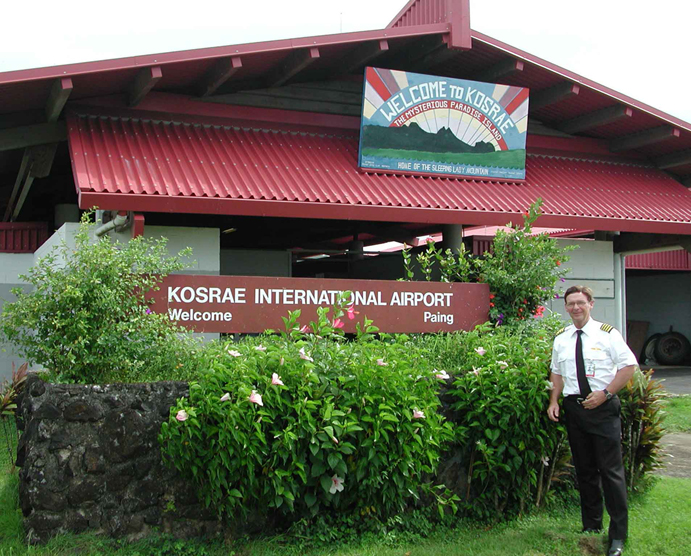
Kosrae is the eastern-most island in the FSM, located approximately 600 kilometers southeast of Pohnpei. Kosrae is a 109 square kilometer island surrounded by a reef. Kosrae is circular in shape, measuring only 16 kilometers across at its widest poin (see map). The second largest island in the FSM, it is the only state without outer islands. Kosrae's natural resources are the unspoiled tropical island and marine resources surrounding the island. The single island that makes up the state of Kosrae is a dense jungle mountainous island with a lush green interior and several white coral beaches around the rim. The interior of the island is characterized by high, steep, rugged mountains rising to 629 meters at Mt Finkol, and covered with dense tropical rainforests.
Legend has it that Kosrae was shaped by the gods from the transformed figure of a sleeping lady. Indeed, the skyline from many parts of Kosrae reveal the silhouette of her head and breasts. Mountains account for 70% of the total land area, so virtually all of the population (approximately 8,000) lives in five costal villages. Several sandy beaches break through the mangrove shoreline to provide easy access to the narrow surrounding lagoon. The reef flats that surround Kosrae are considered to be among the most pristine remaining in the world. A single partially paved road on the east side of the island links Utwe to Tafunsak: other costal villages must be accessed by boat.
The surrounding reef boasts some of the most amazing marine life and barracuda diving in the world. Snorkeling and scuba diving tours are available, and several American planes and Japanese ships are submerged in Lelu harbor. During the December mating season, large numbers of sea turtles congregate near Kosrae. The largest village is on Lelu, a small island connected to the main one by a 730-meter long causeway. Lelu flourished as the feudal capital of Kosrae from 1400 to 1800 AD. Today, the Lelu ruins, made up of criss-crossed hexagonal basalt logs, bear a striking resemblance to Pohnpei's Nan Madol. The network of canals which brought canoe traffic through the city can still be seen. Most government offices, the hospital, tourist office, post office, high school, and the FSM Telecom Corp. office are located at Tofol, Kosrae's administrative center, about four kilometers from Lelu.
During the peak whaling period of the 19th century, Kosrae was regularly visited by whalers, missionaries and pirates. The most famous was American pirate Bully Hayes who regularly hid out in Utwe Harbor at the bottom of which his ship now forms the basis of an underwater museum. Hayes is thought to have buried his treasure in the vicinity, but nothing has ever been found. Today, Kosrae is the most religious island in Micronesia, thanks to the Congregational missionariy efforts of the mid 19th century. Churches are packed on Sundays, and shops and offices are closed that day. Kosrae is heaven to those who like to find their own way around. The best advice is to hire a car and drive to the various villages, stopping off at some of the more inviting beaches for a swim and a snorkel. Villagers are invariably friendly and hospitable.
Kosrae, even today, remains in the relatively undiscovered category. The island has several quite good hotels and restaurants, and rentals cars are readily available. This land and its friendly people are a unique find in the Pacific. Kosrae (along with Chuuk, Pohnpei and Marshall Islands) is a stop-off on Continental Micronesia's Honolulu-Guam route, and is beginning to be a recognized tourist destination.
Kwajalein
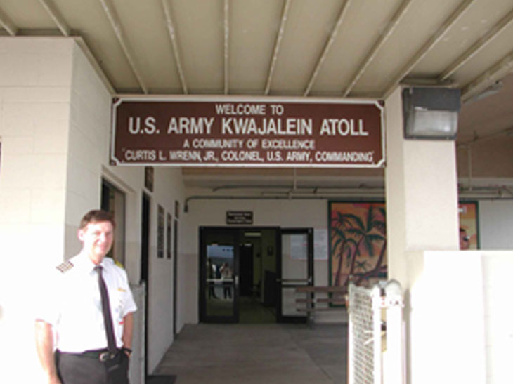
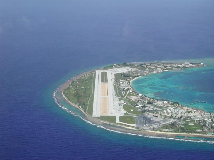
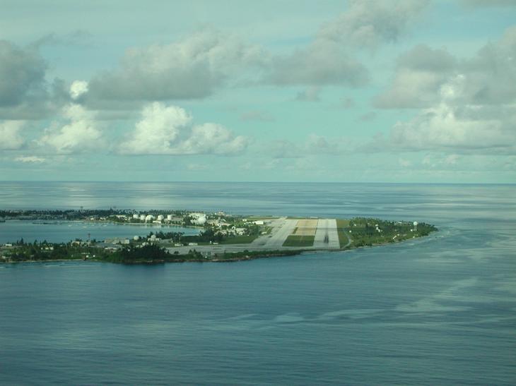
Immediately after WWII, the US Army began establishing bases in the Marshall Islands, known more famously perhaps for the nuclear testing program at Bikini Atoll. Kwajalein Atoll became the eyes and ears of the military in the Australian hemisphere, currently the most highly developed installation of it's kind in the world. The two huge antennas nick - named "Altair" and "Tradex" , rotate and gimbel on circular rails, tracking near - earth orbit objects with millimeter precision.
As a result, Kwajalein has become the splash-down and intercept launch site for the THAAD missile program, a current spin-off of Reagan-era Star Wars "Bright Pebbles" strategic planning. Every so often, the TV crawler announces a launch from Vandenberg AFB in CA, and the civilian employees walk from their homes for the free light-show, standing in the dark at North Point, looking out over the native worker bedroom community of Ebeye, a few miles to the north, until the incoming ICBM warheads streak across the sky to thump into the waters of the lagoon.
Kwajalein currently houses about 1,500 civilian employees, under USAKA domain, working in two separate entities, KLS and IRE, KLS being the logistic support group, and IRE being the missile group. Raytheon and Boeing are the two main contractors, with Boeing likely to win the next five year base support contract as the THAAD program ramps up. Other contractors come and go. The Army presence is very subdued, entirely administrative, but there is a "bit" of bureaucracy.
Expatriate tax-status, the jobs are low - paying by Stateside, but the perks many people consider more than make up for it. There are, for example, no expenses of any kind, all housing, utilities and transportation are included. (For single-status, even the food is free!)
There is no commute, in fact, there are no cars, everyone uses bicycles to get around. And for recreation, there's an endless bonanza, swimming pools, reef snorkeling, low - cost boat and dive rental, golf, bowling, large playing fields, tennis, handball courts, a complete wood and ceramic shop, and library.
Every weekend, free first-run movie play at the Richardson outdoor theatre, it's quite a sight all the bicycles with their flash lights like fireflies between the lanes of palm trees in the moonlight.
Most people who arrive in Kwajalein either get right back on the plane, or end up staying for two or three years, some people have worked here for forty years, if you can imagine! The family housing is better than the married trailers which are better than the single barracks, and for kids it's "da kin", Kwajalein is a return to the 50's, to Tom Sawyer days, no crime, no hectic pace, pure play.
So how do you get here? Take Continental Micronesia from Guam or Honolulu.
Majuro
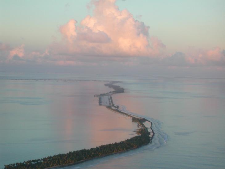
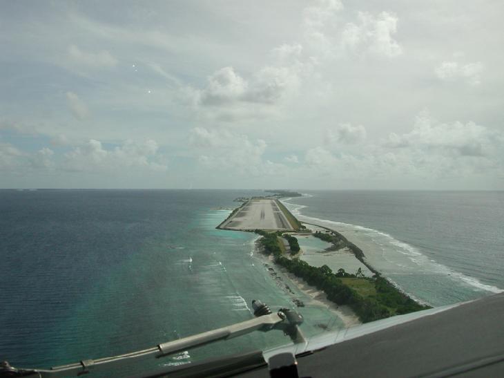
Most visitors to the Marshalls get only as far as Majuro Atoll, the nation's political and economic center and home to nearly half its populace. The atoll has 57 small islets, the largest of which are connected by a single 55 kilometre (35 mi) stretch of paved road, making Majuro appear to be one long, narrow island. Robert Louis Stevenson called the atoll the 'Pearl of the Pacific' when he visited in 1889, but it's a far less pristine Majuro that one sees today.
Majuro is the most Westernized of the Marshall Islands, but there's still a lot that can be learned about life in the islands from a visit. You can grasp what it's like to live on a ribbon of land so narrow that as often as not you can see the ocean on both sides. By visiting Laura Village, at the westernmost end of the mainland, you can find a rural lifestyle somewhat similar to that of the outer islands. While there, make use of the islands' best beach and Majuro Peace Park, a memorial built by the Japanese and dedicated to those who died in the East Pacific during WWII.
Three of Majuro's islands - Delap, Uliga and Darrit (Rita) - combine to form the D-U-D Municipality, the nation's capital and the most populous spot in the country. It's certainly no tropical paradise, but there are a few sights worth seeing. The Alele Museum is small, but its quality exhibits include displays of early Marshallese culture, stick charts, model canoes and shell tools. There's also a copra processing plant and the shockingly modernistic capitol building to visit.
